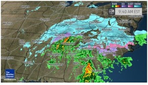
I’m sure most are aware of the impending winter storm we are about to experience in most of New Jersey and the rest of the Mid Atlantic. Here’s the latest update from the NWS.
National Weather Service, Mt Holly, 1/22 Morning Update
>>>Today – Increasing clouds, with a high near 34. North wind 10 to 17 mph.
>>>Tonight – Snow, mainly after 8pm. Low around 30. Windy, with a northeast wind 13 to 23 mph increasing to 23 to 33 mph after midnight. Winds could gust as high as 47 mph. Chance of precipitation is 100%. New snow accumulation of less than one inch possible.
>>>Saturday – Rain before 1pm, then snow and sleet. High near 37. Very windy, with a northeast wind around 40 mph, with gusts as high as 55 mph. Chance of precipitation is 100%. New snow and sleet accumulation of 1 to 3 inches possible.
>>>Saturday Night – Rain, snow, and sleet, becoming all snow after 1am. Low around 27. Windy, with a north wind 32 to 39 mph, with gusts as high as 55 mph. Chance of precipitation is 100%. New snow and sleet accumulation of 3 to 5 inches possible.
>>>Sunday – Snow likely, mainly before 7am. Mostly sunny, with a high near 37. Windy, with a north wind 23 to 28 mph decreasing to 14 to 19 mph in the afternoon. Winds could gust as high as 39 mph. Chance of precipitation is 60%. New snow accumulation of less than a half inch possible.
Click here for a 9AM Weather Channel update. This is a serious blizzard we are about to experience.
